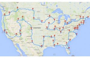
I like road trips, and I’ve long wanted to do one that hits every one of the continental U.S. states. I never actually sat down and mapped it out (though I did do most of the mapping on this road trip from San Francisco to Chicago). Well, now I don’t have to, because a Michigan State nerd/awesome person/student did it for me!
 Yes, that’s right: This map has a stop in every one of the lower 48 states, for a total of 13,699 miles. Bonus: Every stop is a landmark. (However, Carhenge in Nebraska is worth a stop, if you ask me.) Here’s the link to just the map, and you can click on each location.
And, last but not least, here’s the original blog post, with all of the nerdy details. He even released the Python code if you a) know how to use it, and b) aren’t satisfied with Google maps.
Hat tip to Lorelei for the link.